New Brunswick is the only Atlantic province that shares its borders with both Canada and the United States.
Tour and explore the five distinct regions of New Brunswick, listed below the map.
New Brunswick provides access to neighbouring:
Prince Edward Island (via the Confederation Bridge) at Cape Jourimain.
Nova Scotia by both the TCH #2 near Sackville, NB to Amherst, NS;
and by a vehicle ferry service from Saint John, NB to Digby, NS.
Maine, USA at several border crossings. 24 Hour Service is available at:
Fort Kent, ME (US-1) to Clair, NB (Rte 205)
Madawaska, ME (US-1) to Edmundston, NB (Rte 120)
Van Buren, ME (Bridge Street) to Saint-Leonard, NB (Bridge Street)
Limestone, ME (SR-229) to Gillespie Portage, NB (Rte 375)
Fort Fairfield, ME (SR-167) to Perth-Andover, NB (Rte 190)
Houlton, ME (I-95) to Woodstock Rd, NB (Rte 95)
Vanceboro, ME (SR-6) to Saint Croix, NB (Rte 4)
Calais, ME (SR-9) to St. Stephen, NB (Rte 1)
Lubec, ME (SR-189) to Campobello Island, NB (Rte 774)
Quebec via TCH #2, near Edmundston, NB;
and the Gaspe Peninsula at Campbellton, NB.
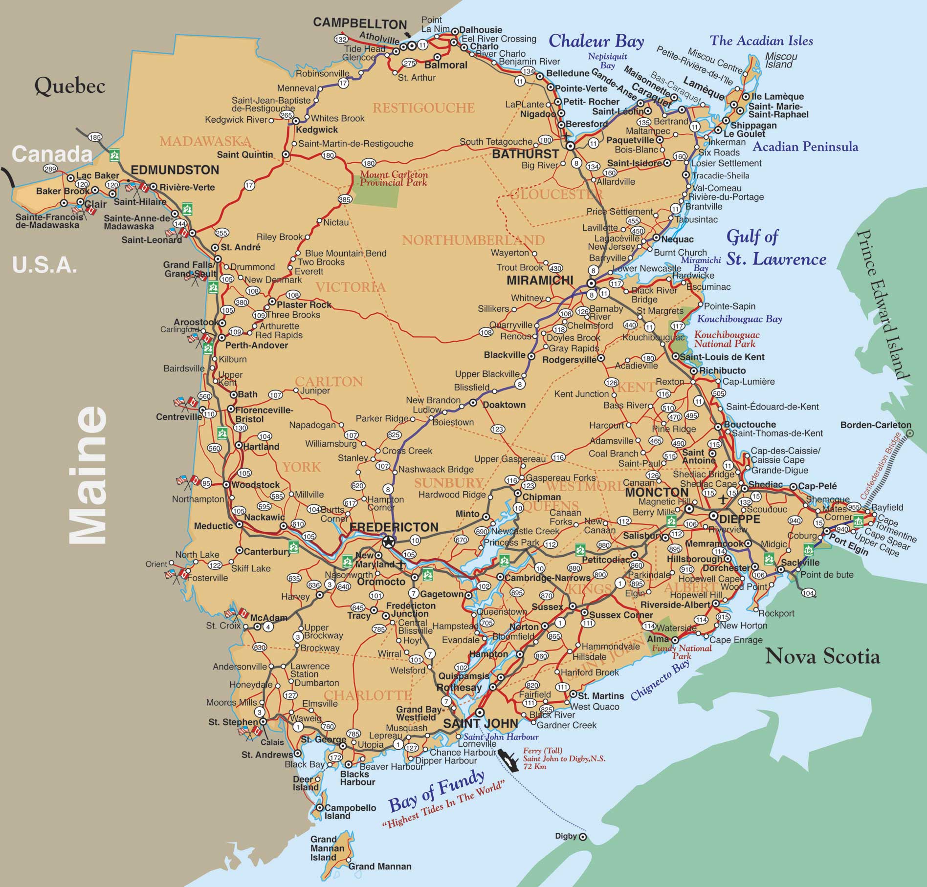
Map©Motorcycle Tour Guide Nova Scotia & Atlantic Canada – no reproduction permitted without permission
New Brunswick is comprised of 5 distinct regions to travel and explore:
Looking for info on local clubs to join a group?